


Page 18 - Froghall Drive Our Story
P. 18
Froghall Drive - the Maps


            Chris French, May 2020


            Introduction

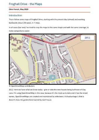
            There follow some maps of Froghall Drive, starting with the present day (almost) and working
            backwards about 200 years, in 7 steps.


            In all cases (bar one) I've tried to crop the maps to the same shape and with the same coverage, to
            make comparisons easier.


            © OpenStreetMap contributors

            2012: Here we have what we know today - give or take the new houses being built east of Clay
            Lane. I'm using OpenStreetMap in this case, because it's the most up to date and it has the street

            names. OpenStreetMaps are created and maintained by volunteers. A disadvantage is that is
            doesn't show the garden/land owned by each house.

