


Page 19 - Froghall Drive Our Story
P. 19
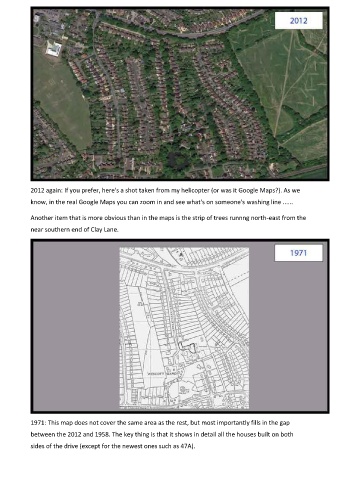
2012 again: If you prefer, here's a shot taken from my helicopter (or was it Google Maps?). As we

            know, in the real Google Maps you can zoom in and see what's on someone's washing line ......

            Another item that is more obvious than in the maps is the strip of trees runnng north-east from the

            near southern end of Clay Lane.


            1971: This map does not cover the same area as the rest, but most importantly fills in the gap

            between the 2012 and 1958. The key thing is that it shows in detail all the houses built on both
            sides of the drive (except for the newest ones such as 47A).

