


Page 30 - Froghall Drive Our Story
P. 30
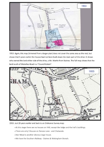
1953: Again, this map (trimmed from a larger plan) does not cover the same area as the rest, but
            shows that 5 years earlier the houses had not been built down the main part of the drive. It shows

            who owned the land either side of the drive, a Mr. Martin from Staines. The full map shows that the
            land south of Waterloo Road is a "Council Estate".


            1933: Just 20 years earlier and back to an Ordnance Survey map:

                  • At this stage there are no houses on FHD, except the lodge and the hall's buildings.
                  • There are only 3 houses on Rances Lane - and Chetwode.

                  • Star Mead is another obvious large house.
                  • We have the Southern Railway - Staines & Wokingham Branch.

